Current Outbreak Status
Southern Pine Beetle Status


Images courtesy of Erich G. Vallery, USDA Forest Service – SRS-4552, Bugwood.org
Key Takeaways For 2025 Include:
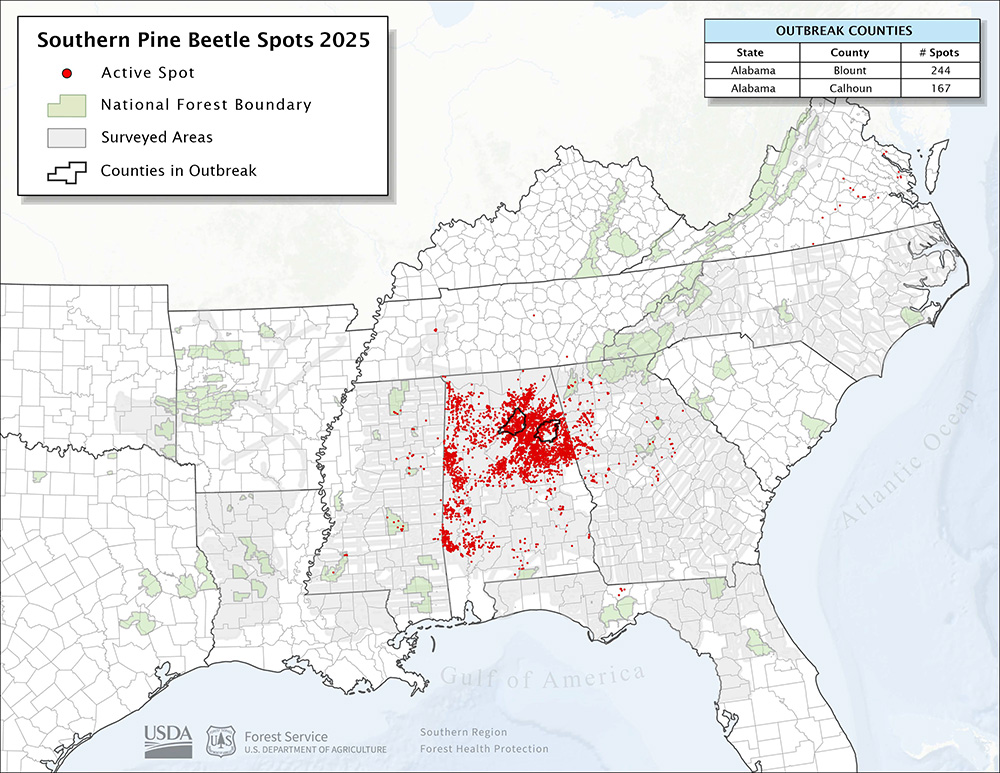
- In 2025, there were almost 5,000 southern pine beetle spots impacting over 12,000
acres of mostly loblolly pine plantations. - While significant, this activity is more than 50% less than the acres impacted in
2024. - Southern pine beetle activity was significant primarily across Alabama, Georgia, and
Mississippi. - As in 2024, Alabama saw the worst SPB activity by far in 2025 with almost 4,500
spots and nearly 11,500 acres impacted. - Two counties and no Forest Service Ranger Districts were officially in outbreak
status, a marked decline from 2024 outbreak levels. - The vast majority of spots and impacted acres were on private forestlands, a sharp
turnaround from the previous decades were SPB activity was typically much more
dominant on federal lands. - This may, in large part, reflect declining markets and widespread mill closures that
lead to increasing hauling costs and decreasing profit margins for loggers. - The eventual result of these trends is that landowners often cannot get critical
management work, such as thinning, done in a timely manner or at all. - This leads to stagnant, stressed stands that are more susceptible to bark beetle
attack. - See Historical Spot Data for a complete data set.
Current SPB Spot Map
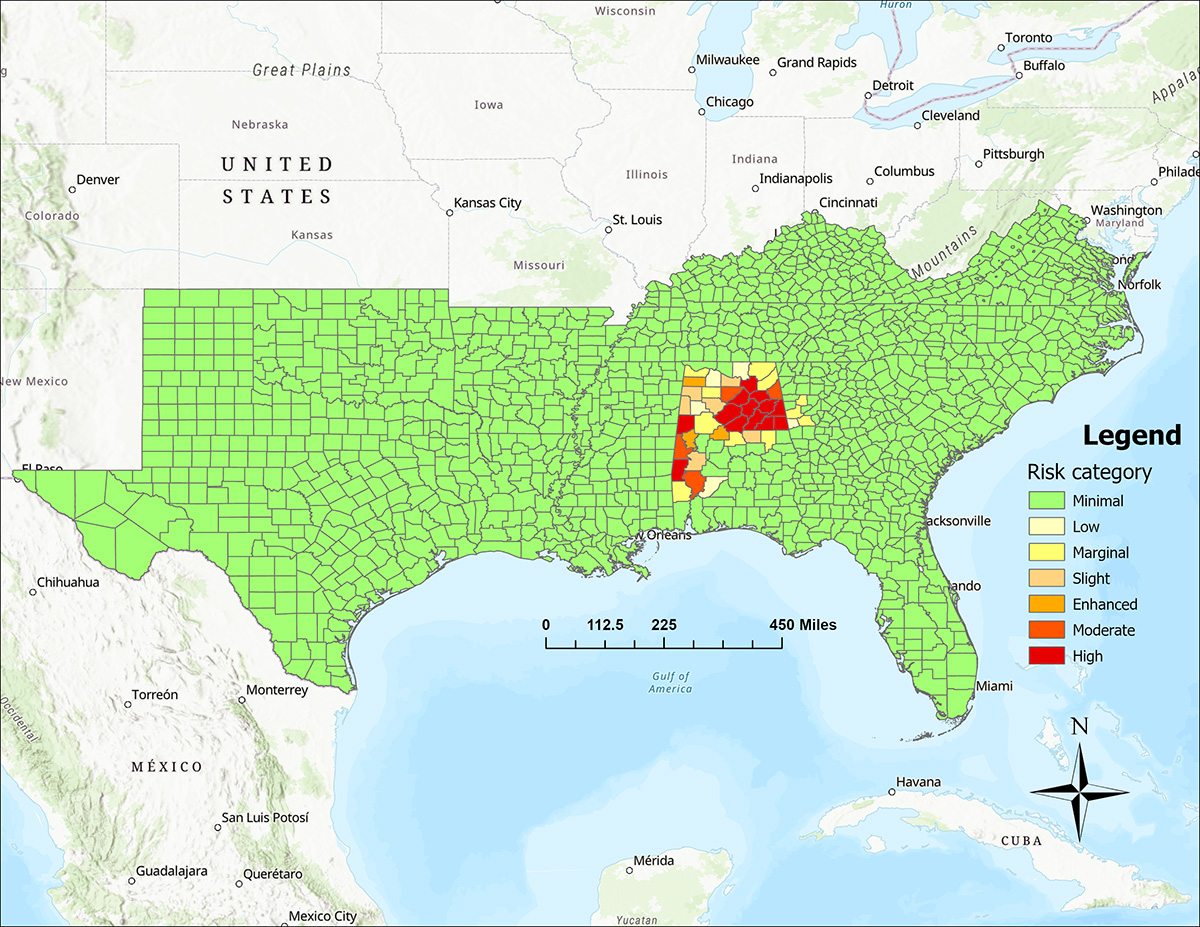
Spring Trapping and SPB Prediction. Every year we conduct a spring survey for Southern Pine Beetle, and we have been working with Dartmouth College to make the predictions for the survey more accurate. Below you will find a summary of the expected SPB activity for 2025 derived from that survey and the prediction model. The map on the left indicates predicted SPB activity in counties across the region, while the map on the right indicates predicted SPB activity on Federal lands. More detailed information about this survey and the prediction model can be found at SPB Predict.
This prediction system is a huge team effort made possible by surveyors and sample processors with National Forests, State Forestry Agencies, and Forest Health Protection. Also, a special thanks to Michael Torbett with Georgia Forestry Commission that manages the Survey 1,2,3 Collection and Reporting App and Drs. Carissa Aoki and Matt Ayres with Dartmouth College that developed and run the prediction model.
2026 SPB County Prediction Map

2026 SPB Federal Lands Prediction Map

Working with collaborators in the USDA Forest Service, Southeastern Climate Hub, and Clemson University, we have developed the Southern Pine Beetle Outbreak Model (SPBOM). This prediction tool forecasts southern pine beetle risk under current and future user-defined management, precipitation, and temperature scenarios, allowing forest managers in the southeastern U.S to identify, monitor, and manage areas at high risk of SPB infestation.